Technology and sailing
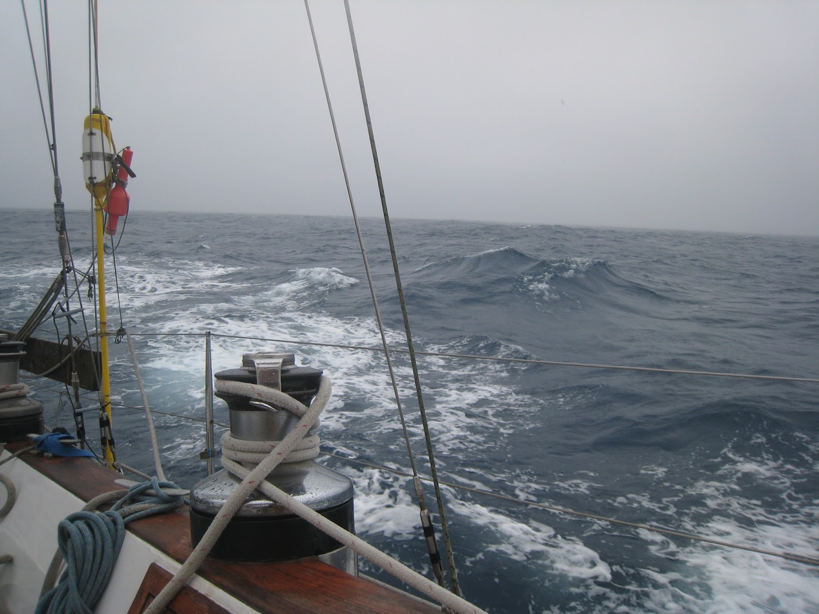 |
| Visibility decreasing as we enter the Bay of Biscay |
Not long ago, when people set sail to cross oceans, they set off with some charts, a sextant, sight reduction tables, pencils, dividers, parallel rules, a compass, a log to measure knots and a clock. If they knew the speed at which they were sailing, and how long they had sailed, they could determine where they were. They would back that up by taking sights on the stars and the sun and calculating their lat and long.
 |
| Side by side AIS and chartplotter courses at close range and longer range. |
It's also my contention that sailors are so busy monitoring the electronics and rely so heavily on their accuracy that they forget the basic principle of the COLREGS (The SOLAS Collision Regulations) which state 'Every vessel shall at all times maintain a proper look-out by sight and hearing as well as by all available means appropriate in the prevailing circumstances and conditions so as to make a full appraisal of the situation and or the risk of collision.' That means looking and listening both inside and outside the wheelhouse or nav station. "All available means" indicates if you have radar or AIS, or a depth sounder for that matter, you must use it to monitor your situation.
One time off the coast of Ireland approaching Aranmore in Donegal, heavy fog descended. We could not see from the stern to the bow much less ahead. We turned everything on, including the electronic foghorn on our VHF. We navigated into the harbour using radar and depth to follow the contours of the land, corroborated by the chartplotter not the other way around. Our 'newest' charts for the west coast are based on 1800s datum and that's what's in the chartplotters. AIS picked up one other boat nearby but not converging. We got in without incident, but what we saw after the fog lifted scared the bejaysus out of us. Roaring water and rocks all around the entrance.
On a recent crossing of the Bay of Biscay, we had our AIS on in crowded waters for the first time. We bought it several years ago but in the west of Ireland, we got excited about seeing any boats at all rather than worrying about collision avoidance. In Biscay, as we approached the shipping channels at night in fog, we monitored everything going: AIS, radar, VHF, depth, chartplotter, binoculars.
 |
| Being chased into harbour by a fleet of fishing vessels. |
Curiously, we suffered a heightened sense of anxiety. Because of the built in alarms, which were constantly going off, we were now monitoring vessels much farther away than we had ever been able to see before, even with binoculars. It was great to see which way they were heading and how our paths would cross. It was great to be able to make early course corrections for collision avoidance. But it was also nerve wracking because there were so many more out there that we could not visually identify, yet we knew they were there.
On the other hand, several fishing boats did not have their AIS on. One I picked up visually on my watch in the middle of the night. I saw lights on the water. Then more lights, strobe lights in multiple places. I finally made out that the fishing boat was towing a giant net and the strobe lights were on the net. I made a 90 degree turn to starboard so he'd know I had seen him. That's when he turned on his AIS and I was able to confirm the direction he was heading. I had made the right maneuver, but if I hadn't been keeping a sharp eye out and relied just on the AIS, we would have gotten caught up in his nets. Not a pleasant circumstance. By the way, as soon as we were clear and I was able to adjust course back to our desired heading, he turned his AIS off again!
Bottom line is that we are required by law and common sense to use everything at our disposal to sail safely out to sea and back. Nothing beats our own computers in our own heads and their input devices of sight and sound. If we don't, we have no one to blame but ourselves.
 |
| The point we rounded in Spain shown on chartplotter above. |
 |
| Fog hugging the coast but thankfully lifting just we entered the harbour. |


Comments
Post a Comment