 |
| Rainbow between Clare and Achillbeg |
It was a strange summer that never happened, with chill winds and rain nonstop. So when the forecast was for moderate winds in the range of 15 knots out of the North, we decided to head off to the Inishkeas. It would be cool but we can handle that. But, as often happens, the forecast was not true to its word and the squalls that blew through with occasional heavy rain, arctic cold, and blasts of wind in the range of 25 knots caused us to divert to Achillbeg to see if the conditions might abate. They did not, which meant we had a lovely day at anchor off Achillbeg.
 |
| The northern hill on Achillbeg |
There are moorings in protected clear aqua waters close to the beach at Achillbeg, but they would not allow us to get to them across relatively shallow water. So we anchored out in the designated anchorage with our Fortress anchor. We used that one because Alex is recovering from four broken ribs and neither one of us could lift any of the other anchors over the pulpit. Fortunately, the bottom is soft sand so the anchor bit fiercely. We love that.
Achillbeg is a small island just 60 hectares (326 acres) in area, forming the northwest boundary of Clew Bay in County Mayo. It is separated from Achill Island by a narrow channel called Blind Sound. The name Achillbeg comes from the Irish
Acaill Beag, or 'Little Achill'. Achill is Ireland's largest island.
 |
| Beach with currach and southern hill |
Achillbeg consists of two hills connected by a sheltered but wet and boggy valley. There is a lovely sandy beach on the protected Bay side and a rocky promontory on the fierce ocean side. The village consists of a ribbon of modest homes built along a high ridge and strung together by a dirt road that runs from the slipway on the Corraun Peninsula side of the island to the sea on the Atlantic side; a second 'road' goes down to the beach and up and over the other hill.
The island's wild and rugged landscape is shaped by the forces of nature, with the Atlantic beating its exposed western cliffs and beaches, and the weather eroding and shaping its hills while it nurtures its green fields. The fields form straight patches of lush green grass bound by rock walls that run from each homestead down into the valley and stop at the bogs below.
 |
| Heading ashore |
Across on the other side of the bogs lies an old schoolhouse surrounded by stone walls, whether to keep the children in or the animals out we could not tell. When standing at the height of the homes and looking down, one could easily watch the children cavorting down below. We wondered where they crossed the bogs to get to the other side.
 |
| Ruins with a stunning view to Croagh Patrick |
In the book
Achillbeg - The Life of an Island, Jonathan Beaumont states that before the Great Famine, the island's population was almost 200. The population declined significantly after the famine and never recovered. By the mid-1960s, enrollment in the school was down to single digits and the remaining inhabitants moved out in 1965. Ironically, a lighthouse was erected on the southern tip in that year, which brought electricity to the island, but it didn't help. As Achill was connected to the mainland by a causeway and bridge, most of the people from Achillbeg simply moved across the Sound. Much of the land is still owned by the families who lived there.
Several old cottages have been renovated as holiday homes and enjoy peaceful surroundings and idyllic views. A promontory fort, Dun Kilmore, was investigated by student archeologist Johanna Ullrich for her PhD with the
Department of Archaeology, UCD. [Latitude, Longitude (decimal degrees):
53.866648, -9.964271]
 |
| The resident. |
Here is a beautiful story about a kayaker's visit to Achillbeg.
From "
On Celtic Tides by Chris Duff.
As we prepared to leave, the sun was playing rhythmically across the Bay and lighting up the Corraun Peninsula and the Nephin Range on one side and Croagh Patrick and Connemara to the other, while the islands of inner Clew Bay were overshadowed by dense black clouds and showers could be seen crossing from one side to the other. We prepared to get wet while wearing sunglasses against the strong morning light peering above the cloud line. It was a beautiful but cold sail back toward home and away from the time travel we had just completed.
 |
| Looking toward Achill and Achill Sound. |
 |
| The old schoolhouse |
 |
| Walking the upper 'road' |
 |
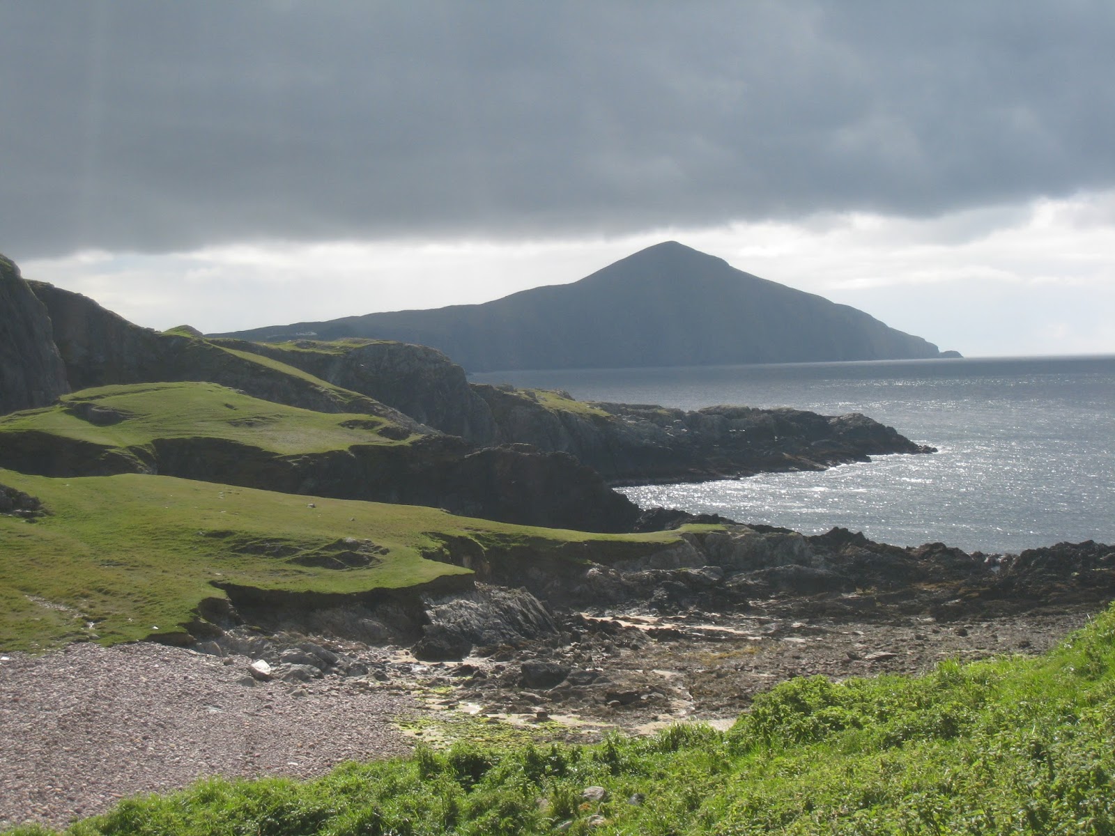
| Western shore and Clare Island |
 |
| Great horns |
 |
| Heading home. |
 |
| The lighthouse on the southern tip |


Comments
Post a Comment